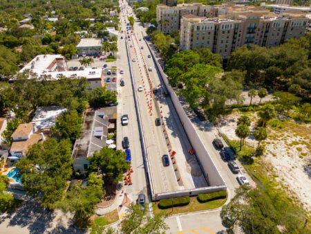
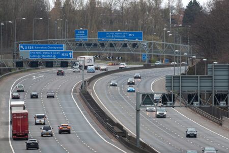
As Florida begins the clear-up operation following Hurricane Milton, we take a look at how hurricane evacuations work, and the lessons learned, on the other side of the Gulf of Mexico in Texas. We also compare the traffic management plans in the USA with Dubai’s response to extreme flooding earlier this year
Around the world extreme weather is becoming more common, with records broken almost every year as the effects of climate change intensify. In July 2024 Texas was battered by Hurricane Beryl – the earliest-forming Category 5 Atlantic hurricane ever recorded; while in April, halfway round the world, Dubai saw an unprecedented level of flooding.
Such intense weather events pose significant challenges for traffic managers who must warn road users as forecasts come in and keep them safe as conditions worsen. Fortunately, at their disposal is an increasingly wide range of sophisticated ITS, coordinated via state-of-the-art traffic management centers (TMCs)
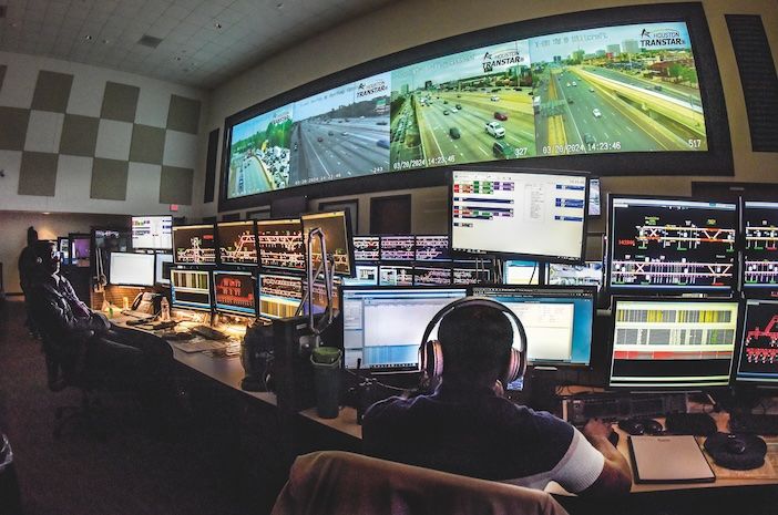
Overseeing hurricane response in Texas is Houston’s TranStar, a unique partnership bringing together over 30 government agencies including the Texas Department of Transportation (TxDOT), emergency management services, and city and county officials, as well as research from the Texas A&M Transportation Institute (TTI).
“Our primary role at TTI is to work with and help provide support to other entities, other agencies, whether local government, state government like TxDOT, or federal partners,” says David Bierling, a program manager at TTI. “We do a lot of transportation research that then gets implemented by the operating agencies.”
This collaborative approach allows for seamless information sharing and decision-making during emergencies. TranStar oversees fiber optic network across the state and maintains over 1,000 cameras on the southeast Texas transportation system, monitored in a central TMC, providing real-time visibility into road conditions across the region, which is vital for real-time traffic management as well as evacuation planning.
While Texas has built up its collaborative traffic management network over decades, in Dubai ITS is still quite new, with its state-of-the-art Intelligent Traffic Management Centre opening just four years ago in November 2020, featuring an advanced traffic control system called iTraffic, enhanced by AI technologies and big-data analysis tools.
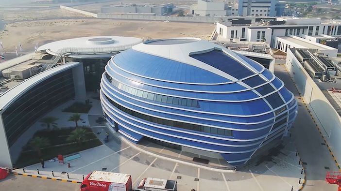
And now, as the ITS World Congress prepares to visit the Middle East for the first time (a technical tour is available of the Intelligent Traffic Management Center at 11am on September 17), Dubai’s Roads and Transport Authority (RTA) has announced Phase II of its ITS project
“We will expand the ITS coverage of the main road network from the current 60% to 100% by 2026”
Excellency Mattar Al Tayer, director general, RTA, Dubai
“We will expand ITS coverage of the main road network from the current 6o% to 100% by 2026,” says His Excellency Mattar Al Tayer, director general of RTA. The project will extend the length of roadway covered by ITS from 480km to 710km.
“This expansion will enhance road network management and traffic flow through better monitoring, faster response times to incidents, and by providing instant information to the public about the condition of the road network via new variable message signs (VMS) and smart applications to help distribute traffic effectively,” says Al Tayer.
Communication strategies
Both Texas and Dubai have learned the critical importance of effective communication during crises, but their strategies reflect the nature and severity of the weather events and the reaction times afforded by forecasts.
In Texas pre-hurricane evacuations have proved effective at saving lives by getting people out of buildings that are later destroyed. But important lessons were learned during Hurricane Rita in 2005 when a mass, mandatory evacuation order caused so much congestion that the evacuation itself claimed lives.
This experience has led to structural changes in how the region manages disasters. For example, the regional Councils of Governments (COGs) have streamlined decision-making processes around evacuations. “The biggest county, Harris with four million people, tends to take the lead,” says Jeff Kaufman, an incident management expert at TTI. “But the COGs allow coordination between counties during events.”

Thanks to these operational efficiencies evacuation orders have been issued in a more targeted, strategic manner in recent years. “In Rita, the message was ‘get out.’ But in Hurricane Ike (2008) it was more ‘hunker down’,” says Kaufman. “For Ike, they said, ‘Only certain people really need to go. Everyone else stay put.’”
This shift in messaging had a profound impact on traffic flow and evacuation efficiency. During Rita, evacuation speeds were about 1km per hour, while for Ike, it increased to 13km per hour. “We improved the information flow, not so much through technology, but more from the political side and hierarchy of how we coordinate messaging,” says Kaufman.
Similarly, for the recent Hurricane Beryl most of the evacuation orders issued to coastal counties were only for residents in low lying and unprotected areas – and they were voluntary. The only mandatory evacuation order was issued in Refugio County by County Judge Jhiela Poynter who said she “didn’t want to take any chances” following the effects of Hurricane Harvey on the county in 2017. As it turned out, Beryl was downgraded to a Category 1 hurricane by the time it reached Texas, but it still claimed at least 64 lives and caused nearly $7bn worth of damage.
“Everything that gets installed is communicating to the TMC through video or sensors. We monitor traffic volumes, comparing what’s happening to what’s normal”
Mike Vickich, senior analyst, TTI
A lesson from Rita, which has helped to bolster the region’s ITS, was that rural camera networks were not mature. Now there are extensive camera networks and sensors along evacuation routes, “After Rita, TxDOT did not have good monitoring ability on many of these rural routes. Now we have eyes on the road to make decisions in real-time,” says Mike Vickich, a senior analyst at TTI.
“Everything that gets installed is communicating to the TMC through video or sensors,” says Vickich. “We’ve got tools set up at the TMC to monitor traffic volumes, comparing what’s happening to what’s normal, looking at thresholds for when the road will break down. That data gets communicated back to the agencies.”
Reaction or prevention?
For Dubai, the recent flash flood came without much warning, therefore there is a focus on bolstering real-time information dissemination for the future. The city’s 112 VMS relay critical updates about changing road conditions, allowing for immediate rerouting of traffic if needed. In the recent floods police suspended all traffic fines, a tactic that could be used again to prevent citizens trying to unnecessarily move vehicles from restricted parking zones, causing additional congestion.
The VMS were part of Dubai’s initial ITS rollout in 2020, which improved incident monitoring by 63%, reduced response times by 30%, enhanced traffic flow, increased traffic management efficiency, and reduced journey times by 20%. Now with Phase II ITS underway, greater benefits are predicted with renewed focus on extreme weather response.
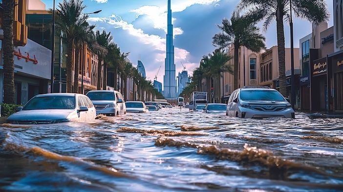
However, one way in which Dubai can better deal with flooding isn’t reactionary but preventative. “In light of the recent rains and floods in Dubai, it is necessary for cities in the Middle East to adopt more resilient urban planning and infrastructure,” says Dr Mohammad Radfar, program director for urban planning at the University of Birmingham Dubai. “The city’s existing infrastructure, overwhelmed by unexpected floods, points to a deficiency in planning for drainage systems capable of managing surface water effectively.”
One of the contrasts between the two regions is the depth of experience in dealing with extreme weather events. Houston benefits from years of hurricane experience, which has allowed for the refinement of their strategies over time. “I have faith in our regional emergency management professionals, having unfortunately had a lot of experience in recent years, that they will guide the evacuation process effectively,” says Bierling.
While Dubai’s problems are much newer, and at least in part, due to the rapidly developing urban landscape which creates expansive hard surfaces not well adapted to handling extreme rainfall events, the city must balance its growth plans with the need for sustainable, flood-resistant infrastructure.
“If 10,000 households evacuate, you could have 12,000 vehicles when people bring extra vehicles to save them from the storm”
Jeff Kaufman, an incident management expert at TTI
Both regions face challenges in their efforts to manage extreme weather events. Houston must contend with the scale of moving thousands of people. “You’re not just planning for people leaving, but the number of multi-ton metal objects heading down the road,” says Kaufman. “If 10,000 households evacuate, you could have 12,000 vehicles when people bring extra vehicles to save them from the storm.” Dubai meanwhile races to get the necessary infrastructure in place to see and control what is happening on its roads.
As these two diverse regions continue to refine their approaches, they give examples of the different ways in which traffic management systems can help to protect lives and property form the threats posed by extreme weather events.
This article first appeared in the September 2024 edition of TTi magazine, where you can read a longer version


