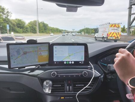
Big data is big business, and it also offers huge potential to revolutionize the way in which local governments analyze the movement of traffic and, accordingly, draw up their transportation policies.
One relatively new player that’s making headway in this sector is StreetLight Data, a San Francisco-based mobility analytics company founded in 2011 that specializes in travel patterns.
“Our job is to illuminate data,” says Laura Schewel, CEO and co-founder of StreetLight Data. “We’re the first – and so far only – online platform for big data in the transportation sector. The availability of that data has only emerged over the past three to five years, and we present governments with a new opportunity to use their resources more efficiently.
“Governments spend a lot of money on data – the figure is around US$1bn in the USA and I suspect it’s probably similar in Europe. Data used to be terrible. For example, government surveys might take place every five years, with a sample of 1,000 people with similar demographics in one place. We realized that the data collection industry could be made better with a faster and more complete service.
“There’s an absurdity to not knowing what’s happening on the roads, given how important it is for climate change, quality of life, pollution, equity and the economy, but now we’re able to do things with data that have never been done before,” she adds.
“Big areas are cycling and parking infrastructure. Transport ministries in states and cities all have a pot of money to invest, so where do they want to put it? We can help them to make decisions by scanning an entire region for relevant data. In the case of cycling, most trips by car are two miles or less, so there’s a latent potential for getting people onto bikes that’s currently lying dormant. This is the beginning of the process, rather than deep into the planning stage, but our systems can help improve efficiencies and maximize the value of a city or state’s expenditure.”
The next stage of the process – and StreetLight’s unique selling point (USP) – is turning data into analytics. Anyone signed up to the company’s InSight system can log in and create new analytics without having to go through any lengthy procurement process.
“It’s not just about making data available – it’s about making it useful so that people can use it in whatever way they want to,” says Schewel. “Cities don’t have the time to put data and software together, which is why we have several modules that are customizable. They can be used to monitor rush hours, which can take place at different times in different cities, traffic hotspots and so on.
“You can analyze different modes of transportation or traffic going in a certain direction – northbound out of town or via certain intersections, for example – so how the software can be used is very flexible. It can also be broadened out, which means we’re seeing a new type of regional data, rather than information that’s restricted to one city.”
In October, the company revealed that it had secured a deal with the Minnesota Department of Transportation (MnDOT) to supply a pilot regional subscription to the StreetLight InSight platform. This state-wide service has been allowing relevant officials from the MnDOT, the Metropolitan Council, the Minnesota Division of the Federal Highway Administration and their designated consultants access to unlimited analyses of travel patterns across Minnesota, including origin-destination, link studies and trip purpose.
The aim was to tackle transportation, event and development projects state-wide in a holistic manner in order to help with planning big events such as the Minnesota State Fair, the Renaissance Festival and, perhaps biggest of all, Super Bowl LII. The NFL championship decider took place at US Bank Stadium in Minneapolis on February 4, 2018.
“Minnesota was a massive project for us, and it was high profile because of the Super Bowl,” says Schewel. “In terms of traffic, the Super Bowl was what I’d call a positive catastrophe! We were doing a lot of research into all of the other NFL games as pre-cursors to the main event, and we also analyzed previous Super Bowls to try to understand the city’s traffic needs.
“It wasn’t just about knowing where the traffic jams were – it was about understanding why they were happening,” she adds. “In many cases, for example, you had people who weren’t going to the game getting in the way. You also had people with relatively high incomes going to the game who weren’t incentivized to park further away from the stadium, as they could afford to pay for parking nearby. These are among the factors that pile pressure on the road network on the day but, because we knew that, there was time to plan for it.”
Less than three weeks before the Minnesota contract was announced, StreetLight also clinched a deal with the Ohio Department of Transportation (ODOT). Here the company is working with Inrix, an organization that also specializes in transportation analysis as well as connected car services and which has worked with the ODOT for five years. Under the terms of this agreement Inrix continues to provide real-time traffic services via anonymous GPS data from connected vehicles and devices, while StreetLight handles analytics to help ODOT measure and report the impact of its transportation policies.
“This was also a big deal for us, particularly because it included the City of Columbus as part of its smart city initiative,” says Schewel. “In this case, InSight combined the power of Inrix data and location-based services data from smartphones with contextual information for a powerful set of analytics.”
A key benefit here and in Minnesota was making the process of accessing and crunching data easier for transportation engineers and planners. “The system changed staff behavior,” Schewel adds. “They weren’t not restricted by a rigid infrastructure because we’d unlocked changes in the data process. We were seeing more data queries in two months than we’d previously seen in a year, partly because the staff had the opportunity to play and explore. That led to progressive thinking, and the feeling that they were part of something new – the smart city and, as a natural extension of that, the smart state.”
This is precisely the sort of project that StreetLight envisages playing a lead role in over the coming years, Schewel says. “In the longer term we will see more states using big data and we have several ambitions for the future: we want to link those states together, to create user groups where they can share best practice.
“We are creating new modules for green transportation, cycling, pedestrians and vehicle miles traveled (VMT) tracking, which is a particularly big concern here in California. We also want to expand across the continent into Canada to the north and Mexico to the south.
“And finally the aim is to use more science in the analysis of data. At the moment the system is designed primarily for transport engineers, but as we grow we will broaden the system out so more people can use it.”
Science, she believes, will have an increasingly important role in how we travel in the future as concerns over the environmental impact of motoring. “In transport there’s also a climate change mandate – and we have to change if we want the planet to survive.”
Recently, StreetLight Data has announced new projects and initiatives:
StreetLight Data launches new Multimodal Measurement Initiative to study travel interactions Arizona selects Inrix and StreetLight Data for real-time traffic analysis and planning StreetLight Data launches new congestion diagnostics tool for transportation planning


