A multi-partner European project has achieved positioning accuracy for an autonomous truck using data from the Galileo global navigation satellite system (GNSS), in combination with other positioning and sensor technologies.
Autonomous vehicles and their advanced driver assistance systems need robust and precise positioning information to enable reliable operations, which will be particularly important during the early transitional phase of the technology, when other vehicles around them will not be automated. The new and innovative positioning solution was developed in the European PRoPART (Precise and Robust Positioning for Automated Road Transports) project, which has involved Swedish truck maker Scania and six other partners. The project team believes the centimetre-level positioning system could be a key enabler for autonomous transport in the future.
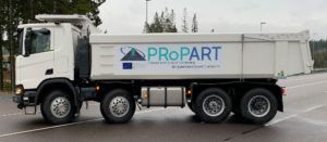
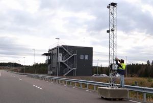
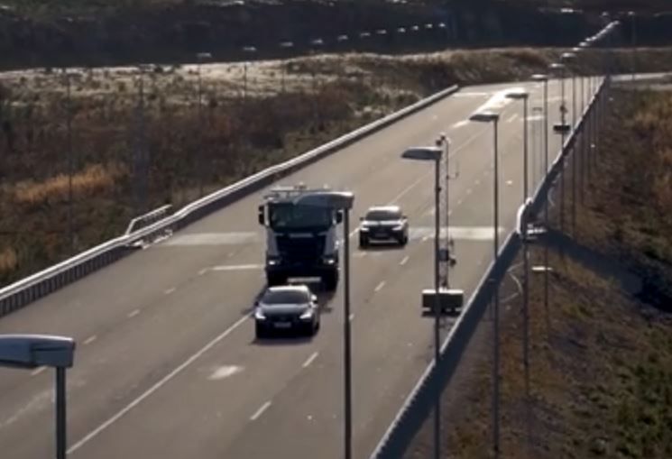
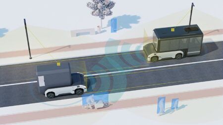
 The solution was demonstrated in a recreated motorway situation at the AstaZero test facility in Sweden, with a connected autonomous truck and two unconnected manned cars. As part of the test, a Scania self-driving truck executed a safe and efficient lane change in traffic. The manoeuvre was managed by the new system, relying on centimetre-level positioning combined with collaborative perception sensor data. The project demonstrated that it was possible to pinpoint the position with 10cm (4-inch) accuracy. The truck could execute the manoeuvre due to the precise positioning and an accurate representation of the whole surrounding environment. This was achieved by fusing data from the truck’s camera and front and side radars combined with radars mounted on roadside units (RSUs).
Coordinated by the RISE Swedish Research Institute, the project received funding from the European GNSS Agency under the European Union’s Horizon 2020 innovation programme. The multinational PRoPART project combined Real Time Kinematic (RTK) positioning software from Waysure (Sweden) with satellite measurements from Fraunhofer IIS (Germany). The satellite positioning was augmented with an ultra-wideband ranging solution from Spanish research institution Ceit-IK4. The self-driving truck was supplied by Scania, with Hungary-based V2X company Commsignia providing the short-range communication technology. Baselabs from Germany provided sensor data fusion of onboard and roadside sensors and developed a situational assessment for the intended automated lane change manoeuvre.
 “In addition to positioning, we’ve also added infrastructure-to-vehicle communications,” said Stefan Nord, project coordinator from RISE. “Ordinarily, autonomous vehicles rely on their own sensors to interpret and process data on the surrounding environment. But if vehicles share information, you can extend their horizon and benefit from data from another vehicle to also look around the corner and thereby gather more data as a basis for manoeuvring decisions.”
Fredrik Hoxell, a development engineer at Scania Intelligent Transport Systems, explained, “In the project, we focused on achieving a positioning error below 20cm in combination with an ambitious target integrity risk – that is, the probability of the position error exceeding this error limit. However, for deployment in real-life traffic situations, which tend to be much more dynamic and unstructured, there are of course many more vehicle and system characteristics and possible sources of errors that need to be handled. Reliable and high-integrity navigation is absolutely essential when operating autonomous vehicles in uncontrolled environments. These trials offer one possible facet of the overall challenge related to navigation support on the journey towards safe and sustainable autonomous transport.”


