Researchers at the US Department of Transportation’s (USDOT) Volpe Center are using new ‘crowdsourced’ data sources from the private sector to estimate where and when motor vehicle crashes are most likely to occur.
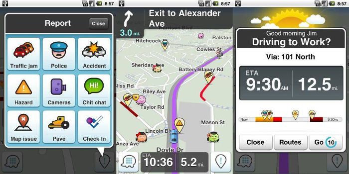
Crowdsourced mobile applications are an emerging and rich source of real-time data about roadway conditions, and the Volpe project has been researching how this information can help estimate crash risk. The crowdsourced Waze app passively collects information about traffic conditions when users have it open on their smartphones and tablets. The app also allows users to actively report information about accidents, weather conditions, traffic jams, road closures, and road hazards. In a 2017 pilot study, Volpe Center researchers integrated user-reported crash information from the Waze app with crash data from the state of Maryland. The team used a machine learning approach to estimate where and when police-reportable accidents were likely to occur over a six-month period. The model provides accurate estimates of crash risk within one-mile-area grid cells across the state of Maryland.
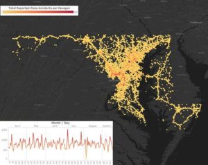 The Volpe Center team has since extended the Waze crash estimation models to a full year, and to three additional states: Virginia, Connecticut, and Utah. The analytical approach can support nationwide studies or state and local applications of Waze data. The Volpe Waze pilot is part of the USDOT’s Safety Data Initiative (SDI), which aims to better understand and mitigate crash risk by integrating public and private data sources. Models that estimate the timing and location of crashes can help emergency responders, traffic management centers, and law enforcement proactively allocate resources to locations with the highest accident potential. The first phase of the Waze pilot project provided the foundational research to develop Waze applications in collaboration with local and state agencies.
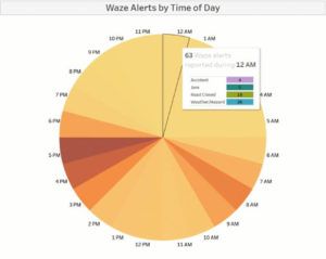 The city of Bellevue in Washington is also collaborating with the Volpe Center to test if Waze data can offer novel insights to support its Vison Zero program to reduce traffic deaths by 2030. The Volpe team integrated several sources of traffic data to create interactive dashboards that city transportation officials can now use to identify traffic crash patterns. The team is also developing crash estimation models to identify conditions, times, and locations with high crash risk to guide Bellevue’s transportation safety investment decisions.
The Volpe team is also working with the Tennessee Highway Patrol to integrate Waze data into the state’s existing crash prediction model. Tennessee’s current model estimates crash risk across 42 square mile grids and in four-hour time blocks. Volpe researchers are using the high-resolution Waze data to develop a model that can predict crash risk every hour for one-square-mile grids. The improved model will help the Highway Patrol better target high-risk times and areas when they prioritize patrol locations.
Led by Erika Sudderth and Daniel Flynn, the Volpe Center performed the original pilot study on behalf of the USDOT’s Bureau of Transportation Statistics, and is now implementing the state and local case studies on behalf of the agency’s Office of the Assistant Secretary of Transportation Policy.


