A team from the University of Arkansas (UA) will make use of ‘big data’ taken from the Internet of Things (IoT) to create real-time, interactive maps and other geospatial information that will help government agencies and industry plan, build and maintain the USA’s transportation infrastructure.
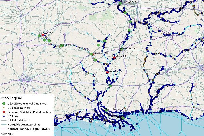
Over the next three years, researchers at the UA will use a US$1.5m award from the US Department of Transportation’s (USDOT) Maritime Administration (MARAD) to develop the Transportation and Maritime Analytics Partnerships Hub, or ‘TransMap’. The research will include new systems and technologies, made possible by the IoT’s massive network of interconnected devices that will ensure a reliable and efficient multimodal transportation network, including roads and highways, rail lines and waterways. TransMap will be a ‘visual decision space’; an interactive map and decision-support tool that will help transportation officials plan and manage infrastructure, while also giving ordinary citizens a powerful tool to efficiently
evaluate increasingly complex transportation networks.

The project will be led by Heather Nachtmann, professor of industrial engineering and director of the UA-led Maritime Transportation Research and Education Centre (MarTREC). She will be joined by UA colleagues Justin Chimka and Chase Rainwater, associate professors of industrial engineering; Jackson Cothren, professor of geosciences and director of the university’s Centre for Advanced Spatial Technologies; and Jim Kruse, director of the Centre for Ports & Waterways at Texas A&M Transportation Institute (TTI). The research team will exploit existing smart technologies and software to develop a new, integrated system that will capture, curate and disseminate high volumes of data in visual format.
The researchers will rely on the IoT as their primary data source. The IoT is a rapidly developing system of interrelated computing objects and devices with embedded sensors and on-board data processing and communication systems that provide automated services that would otherwise would not be possible. Rather than a single technology, the IoT involves the convergence of sensors, actuators, information and communication technologies that work together to collect and aggregate information and enable intelligent systems to understand context and track and manage complex interactions.
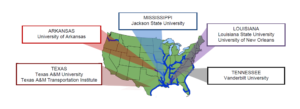
MarTREC is one of 20 centres across the country designated as a USDOT Tier 1 University Transportation Centre. The centre is a consortium of researchers from: Jackson State University in Mississippi; Louisiana State University; the University of New Orleans; Vanderbilt University; Texas A&M University; and the TTI. MarTREC researchers are nationally recognized experts in maritime and multimodal transportation, which integrates trucking, rail and barge carriers. Although the TransMap’s funding has come primarily from maritime sources, the research will cover all modes of surface transport.
“Efficient, resilient and sustainable multimodal transportation is a national priority,” said Nachtmann. “Forward-thinking policymakers understand that we must rely on large-scale datasets, which already exist, to meet the challenges of our nation’s complex and ever-changing transportation system. The role of visual realism in communicating and understanding spatial change and process is critical in making good decisions about building, managing and maintaining transportation infrastructure.”


