The Ray and the Webber Energy Group at the University of Texas, Austin have partnered to create ground-breaking mapping and research in solar energy.
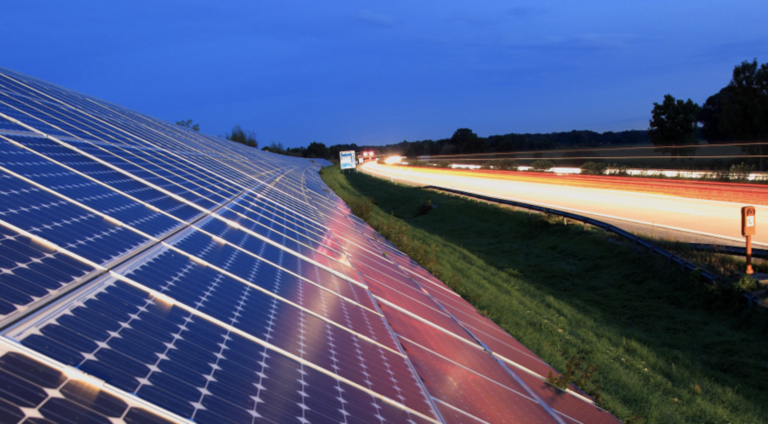
The Webber Energy Group analysed the unpaved roadside areas at exits on the U.S. interstate system for solar energy generation potential. Through an interactive web-based tool hosted at www.TheRay.org, each of the lower 48-states now has access to projections of how much solar energy could be generated on their interstate exits.
According to the analysis, most states have more than 200 miles of interstate right-of- way (ROW) at exits suitable for solar development, which combined could generate up to 36 TWh per year of clean energy, and provide approximately $4 billion in economic value to State Departments of Transportation (State DOTs).
“Interstate solar just makes sense,” said Harriet Langford, founder and president of The Ray. “Like my daddy, Ray Anderson, used to say, this is ‘so right, so smart.’ As our transportation systems become smarter and electrified, we will need more energy available, closer to the interstate and interstate exits, and more funding to support the infrastructure demands. By enabling renewable energy generation using the idle roadsides, our DOTs can help to fill this gap.”
A video explaining roadside solar installation can be viewed here.
“The aim of this project is to provide a report and mapping tool by which State DOTs or other interested parties can assess the potential for installing solar in the interstate ROW in all contiguous 48 states. We have found that when stakeholders have unbiased information available to them, they can make energy decisions with a lot more clarity and confidence,” said Michael Webber, Josey centennial professor in energy resources and professor of mechanical engineering at UT. “That’s our goal with this study: to help people understand the potential for interstate solar so that policymakers, developers, and investors have a clearer view of the opportunity.”
Individually, most states have interstate solar potential in the thousands of GWh per year. At a typical retail price for electricity of ~$0.10/kWh and a wholesale price of ~$0.02/kWh, this means states could generate carbon-free electricity with a value of millions to tens of millions of dollars each year ($2.5 to $181.4 million/year, depending on the state). State DOTs can also take advantage of operational cost savings – like reduced roadside maintenance and reduced energy costs – and even new revenue streams, over the lifetime of the project, which could be 30 years or more.
“On day one of these projects, State DOTs win,” said Laura Rogers, director of strategic partnerships at The Ray. “State DOTs have a lot of options when structuring ROW renewable energy projects. Depending on their priorities and goals, State DOTs can own the renewable energy system and use or sell the clean energy generated, or they can work with a solar developer who owns the system and collect a land fee, while at the same time transferring land maintenance obligations to that developer. Where available, the State DOTs can also retain solar renewable energy credits that they can use to meet greenhouse gas reduction or renewable energy generation goals, or they can sell the credits and keep the revenue,” Rogers added. “No matter how they decide to structure the deal, State DOTs win on all fronts by optimising underutilised land to generate clean renewable energy that benefits their communities, the environment, and their budgets.”
Interstate roadsides are appealing areas for renewable energy development for many reasons including: unshaded acreage, ease of access, public ownership status, and lack of competing development efforts. Because exits have more room to accommodate the transportation safety requirements, such as safety setbacks, they are ideal locations for solar development.
However, not all State DOTs have publicly-available, full spatial ROW data sets, which presented a barrier to specific assessments of and planning for solar arrays in the ROW. Because of the data gap, Iowa was identified to have sufficiently detailed, public ROW data available, and a methodology based on the Iowa case study was developed for this analysis and applied to the remaining states. Google Earth tools were used to measure the available area along ROWs with potential for solar installations. Exit type and quantity, as well as expected solar potential and monetary electricity value, were estimated using a custom interstate exit identification and classification tool.
In February, the Georgia Power Company commercialised a one-megawatt solar array on the ROW at Exit 14 off Interstate 85, which is known as “The Ray Highway.” Georgia is the third state in the nation to utilize interstate property for renewable energy development. The project on The Ray Highway also pilots the use of native, flowering plants as ground cover within the solar array, making Georgia the first in the nation to install pollinator-friendly ROW solar. Currently, The Ray is assisting transportation operators in five other states to develop similar projects on their own interstate roadsides.


