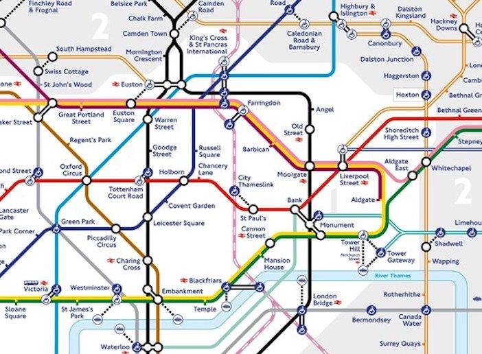
Transport for London (TfL) is proving the power of maps by making a small addition to its famous Tube map in order to make social distancing easier for its customers.
The temporary addition to the map is of mainline Thameslink services, which run from Brighton on England’s south coast to Bedford to the north of London, but in fact also connect several Underground and mainline stations within the city center.
It is hoped the additional information will help further encourage use of public transport to safely travel across the city, aiding social distancing and reducing the risk of a car-led recovery. Step-free information for all Thameslink stations shown will also be added, further aiding those with accessibility needs who need to travel around London.

“In light of the continuing coronavirus pandemic, and next year’s Northern line closures required to complete the Bank Upgrade works, Thameslink services have been temporarily included on the Tube map to help customers move around the city,” says Julie Dixon, head of customer information and partnerships at TfL. “This has been a complicated addition to make to the map, but one that we feel will benefit Londoners as part of our work to promote safe, clean and reliable public transport use across the city.”
The UK Government’s latest guidance makes it clear that everyone should try to reduce their journeys where possible, but those who need to travel can take simple steps to do so safely, such as using TfL’s travel tools to plan ahead for the quiet times and routes.
An enhanced cleaning regime on London’s transport network continues to make the network cleaner than ever. Trains and stations are cleaned with hospital-grade cleaning substances that kill viruses and bacteria on contact and providing ongoing protection.


