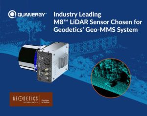
Lidar (Light Detection and Ranging) sensors and smart sensing solutions firm, Quanergy Systems Inc., has revealed that its M8 lidar sensor has been selected for the Geo-MMS lidar product line by Geodetics, a leading provider of lidar-based drone mapping systems.
Quanergy’s M8 unit offers the industry’s leading lidar solution with the best performance in the market for mapping. With a compact form factor, it has a high point cloud density that is three times that of competitors and a more accurate range and fine resolution than the current market offering, with 0.033-degree angular resolution and 3cm range accuracy. After conducting a series of drive and flight tests to validate the sensor’s performance, Geodetics has added the M8 sensor to its lidar mapping and photogrammetry systems offering the best range and number of returns for Geo-MMS customers. By incorporating Quanergy’s M8 sensors and making necessary updates to Geodetics existing system, the Geo-MMS product line now provides up to 410 feet (125m) effective range and three returns for any drone mapping applications, allowing it to fly at the highest altitudes with the highest resolution for commercial drones.
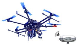
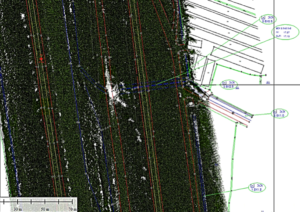
Geodetic’s Geo-MMS system is a cost-effective modular system for vehicle and drone-based photogrammetry, lidar mapping and creation of RGB/multi-spectral colorized lidar point clouds. Geodetics customers have used the Geo-MMS product line in a wide variety of survey applications, including drone mapping in transport infrastructure projects. The traditional management of roads and highway systems is expensive and time consuming for transportation agencies around the world as it involves a full crew equipped with expensive instruments, such as total stations and/or terrestrial laser scanners. Using drone-mounted lidar systems such as the Geo-MMS road mapping system, data collection and data post-processing tasks are performed far more efficiently, significantly reducing time and cost.
“At its core, lidar is a mapping technology, and while it has made its name as an important component for autonomous vehicles, these detailed maps are crucial for many other industries as well,” said Dr Louay Eldada, CEO of Quanergy. “Geodetics is one of the most accomplished companies in drone mapping and the fact that they have selected to partner with us speaks volumes to the superiority of our lidar sensors.”
Dr Lydia Bock, CEO of Geodetics, said, “The range and number of returns offered by Quanergy’s M8 make it the most compelling option for our customers. With the integration of the M8 with our Geo-MMS product line, we can now offer the most advanced drone mapping systems on the market.”


