Crowdsourced traffic information and navigation application company Waze has announced that data from its connected cities program will now be hosted on the Google Cloud, allowing partners to review, visualize and analyze transportation patterns with new tools.
Waze for Cities data, formerly known as the Connected Citizens Program, launched in October 2014 with 10 city partners and has now grown to more than 1,000 partners globally. The free, collaborative program makes use of mobile technology and crowdsourced traffic data to empower municipalities and first responders to improve their existing city infrastructure. By hosting the information on the web-accessed platform, Waze’s partners will now be able to review and analyze travel and traffic patterns, creating visualizations using the Google Cloud’s suite of tools for the first time.

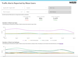
With the availability of Waze for Cities data on the Google Cloud, partners will have access to the best-in-class BigQuery data warehouse tool and the Data Studio data visualization tool. These tools will make the data even easier to interpret and communicate to non-technical audiences. Partners can analyze up to 1TB of data and store up to 10GB of data for free each month. With this program, partners can also securely and privately store and analyze their own data and perform their own analytics buttressed by Waze’s Cities data. As with all Google Cloud partners and customers, Waze for Cities partners will remain in complete control of their data.
In the UK, 12 partners covering the West Midlands, Oxfordshire, Essex, Greater Manchester, Leeds, Middlesbrough and London will be able to access and analyze mobility patterns with Waze for Cities data to help manage current traffic and plan for the future. Transport for West Midlands (TfWM) is the first UK partner to integrate the Waze and Google Cloud data.
 “Waze for Cities’ integration with Google Cloud has enabled us to access a vital amount of information about our local road network,” said Anne Shaw, TfWM’s director for network resilience. “Consistent across a wide area, we’re able to trace issues on the road along with other points of the network, like looking at the performance of traffic lights or the conditions of a certain road. The free data has helped us revolutionize our transport monitoring and coordination systems working within our wider transport partnership with transport authorities and operators.”
Dani Simons, head of public sector partnerships at Waze, said, “We have been a pioneer in sharing data with cities and working with them to improve infrastructure and fight traffic. But over the past five years, the landscape has changed. Cities have more data than ever, but they want better tools to analyze it and be able to put it to use to improve their streets. We are thrilled to provide this integration with Google Cloud that will make it even easier for our partners to more seamlessly organize, store, interpret and share transportation data and insights.”
Google Cloud’s director of product management, Sudhir Hasbe, said, “Waze for Cities Data partners will no longer need to build their own tools or have different systems for different data sources. The integration with Google Cloud will make it easy to view Waze for Cities Data and layer in other transportation-related data sources to see the full picture of mobility trends and interventions in one place.”


