The European Global Navigation Satellite Systems Agency (GSA) is in the process of introducing a new system that exploits the accuracy of its Galileo GNSS constellation to provide public administrations with advanced ‘smart city’ planning technologies.
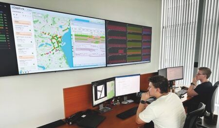
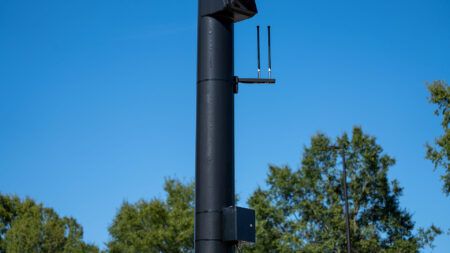
Funded by the European Union’s Horizon 2020 program, the GSA’s GHOST (Galileo Enhancement as Booster of the Smart Cities) project is designing, developing and validating an intelligent system for vehicles that equips existing public transport fleets with a Galileo-enabled camera and connects these vehicles to a web portal. The system automatically takes pictures of predefined points of interest (POI) based on the accurate position of the vehicle provided by the Galileo constellation. All images are sent to a processing server capable of detecting anomalies such as potholes or a burned-out street light, and the system then uses the web portal to report these findings to the relevant authorities.
Across Europe, the number of smart city projects are multiplying, and to tackle their growing needs and to guarantee efficient planning and maintenance, many authorities are engaged in massive investments in key areas such as street lighting, public transportation, road maintenance, traffic and waste management. The exploitation of Galileo and its integration with other sensors is key to developing concrete solutions for current and future smart city planning. By taking advantage of the many vehicle movements happening in cities every day, GHOST proposes a competitive way to improve the efficiency of monitoring urban operations and infrastructure.
The GHOST system’s key differentiator is its use of Galileo positioning, which gives it the ability to take autonomous snapshots with an error range of 3-33ft (1-10m), depending on the size of the POI. In densely populated urban environments, such a level of service is only possible with the combined use of Galileo, inertial sensors, and Kalman filters (an algorithm that uses a series of measurements observed over time, as opposed to a single one, in order to increase precision).
The GHOST system’s key services include:
Reporting street lighting anomalies and road deteriorations;
Monitoring public garbage collection levels;
Helping to reduce traffic, accidents, and vehicle-based air pollution;
Detecting double parking infractions or disabled parking spaces occupied by unauthorized vehicles;
A free smartphone application that citizens can use to collect geo-localized snapshots.
“In addition to these basic functions, we have also identified more advanced services, such as spotting bus-lane and congestion-charging-area violations, which will be implemented at a later date,” explained the GSA’s GHOST project coordinator, Claudia Maltoni.
“Whenever an individual user sees an anomaly within a city’s infrastructure, all they have to do is snap a picture with their smartphone. This level of engagement not only enhances the overall system, but also empowers individual users to play a key role in urban upkeep. Thanks to our field tests and favorable lab results, we are already setting up the next phase of the project, with the aim of taking the system’s technology to the next level. This includes providing real-time, onboard image processing so that the system can handle dynamic scenarios.”


