German traffic technology and speed and red-light camera systems manufacturer Vitronic has started work on a project to trial the use of its enforcement systems to gather traffic data for smart city applications.
Currently, fixed, semi-stationary and mobile speed enforcement systems are used to ensure drivers observe legal speed limits and are basically image processing units used primarily to ensure better road safety.
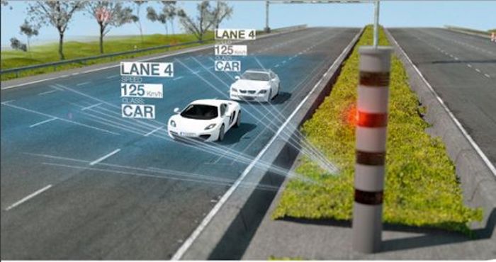
However, systems from the Vitronic’s lidar-based PoliScan product portfolio do more than just measure excessive speeds, define vehicle classes, capture red light violations and ensure the correct use of lanes, as they also gather additional real-time information about the configuration of traffic flow.
As the speed cameras are already digitally connected to back-office violation processing systems, this valuable data could also be accessed by other smart city applications.
In Germany, initiatives that address the UN’s Sustainable Development Goals (SDGs) concept are already underway, and are known as ‘City of the Future’ projects. As part of these initiatives, Darmstadt was named the ‘model city for digitization’, with goals that include: a resource-optimized configuration of urban infrastructure systems, sustainable mobility and logistics concepts, the integration of existing public infrastructure elements in digital solutions, and new sustainable business models for operating intelligent infrastructures.
Darmstadt already has an infrastructure that includes environmental air quality monitoring stations, as well as a network of pillar-mounted Vitronic speed enforcement camera systems.
In partnership with the Darmstadt University of Applied Science, Vitronic has started working on a project entitled ‘Sustainable Traffic Area Management’, using data from its PoliScan speed enforcement pillars within the city.
The project team is collecting general traffic data captured at the speed enforcement sites in an anonymous format to see if it can be used in traffic control systems and then linked to environmental data, to enable a sustainable traffic area management program that improves vehicle flow in the city, reduces noise and air pollution, and improves the quality of life for residents.
Other potential applications for the speed camera data include:
• Because the data is digitally captured in real time it can be sent directly to city administration departments for analysis in future planning decisions;
• It can be distributed to other stakeholders interested in it who may want to create graphics for online media channels, develop new smart mobility apps, or optimize goods delivery routes;
• As the PoliScan speed monitoring systems can capture the flow of vehicles in different lanes and in both driving directions, the data could be interfaced with other traffic control systems, including the communication of congestion information and offering alternative routes. This could also be provided by a smartphone app that sends the user up-to-date traffic information via push notifications;
• Since the infrastructure, and its operational prerequisites such as a power supply, already exist in the urban landscape, camera systems and other similar elements such as street lights could serve as wi-fi hotspots.


