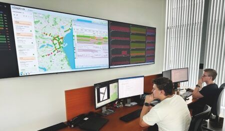
The Rhode Island Department of Transportation (RIDOT) has formed a data-sharing partnership with Waze that will provide a feed of travel time information on the agency’s statewide network highway message boards.
Waze operates the world’s most widely used free, real-time crowdsourced traffic and navigation smartphone app, and the new partnership is part of its Connected Citizens Program. Waze will provide the data at no cost to RIDOT, which previously paid US$200,000 annually for travel time information.
Designed as a free, two-way data share of publicly available traffic information, the Connected Citizens Program provides partners with real-time, anonymous, Waze-generated incident and slow-down information directly from drivers using the app.
In exchange, RIDOT provides real-time construction, crash and road closure data to Waze, giving both parties a thorough overview of current road conditions.
The travel times will initially appear on four of Rhode Island’s network of electronic dynamic message signs (DMS), three on I-95 and one on State Route 4, with additional signs to be added to the travel time program through the autumn.
“We’re pleased to be able to leverage the power of this travel information, which most of us have access to through our smartphones, so it can be shared with everyone and get these message to drivers quickly and safely,” said RIDOT’s director, Peter Alviti Jr.
“It’s also another legacy issue we’ve tackled, saving money for taxpayers, while providing improved service.”
Thais Blumenthal de Moraes, Waze’s head of the Connected Citizens Program, commented, “We are thrilled to partner with RIDOT and help them to save resources, while gaining a deeper understanding of real-time traffic conditions.
“We are the only service in the world to offer this type of civilian content, and we’re excited to work with RIDOT and help reshape their state to better accommodate new citizen needs.”
Carlos C Machado, division administrator for Rhode Island for the Federal Highway Administration (FHWA), which provided funding to establish the state’s network of DMS, noted, “We are an avid advocate in using these signs to provide travel time information to the traveling public. Travel time information can help reduce congestion, lessen bottlenecks, and decrease driver anxiety, thereby mitigating crashes and saving lives.”


