University of Cincinnati (UC) engineers and computer scientists are helping the Ohio Department of Transportation (ODOT) launch its first fleet of drones to improve highway safety and keep traffic flowing in one of the busiest driving states in the USA.
Congestion is both a major problem and a safety issue in Ohio, where a network of interstate highways connects six Midwestern states. According to the Federal Highway Administration (FHWA), in November last year, drivers logged 9.7 billion miles (15.6 billion kilometers) on Ohio roads, the fifth most in the country.
UC’s College of Engineering and Applied Science has assembled a team of experts in computer science and electrical, mechanical and aerospace engineering to help ODOT use drones to assist its core business functions, such as monitoring traffic, inspecting bridges and improving safety for drivers.
The university is equipping the state with a fleet of drones that can send live images and traffic data to transportation officials as part of a four-year, US$2m contract. The Ohio research program is part of a wider US Department of Transportation (USDOT) initiative to study the use of unmanned aircraft systems (UAS) on the country’s transportation network.
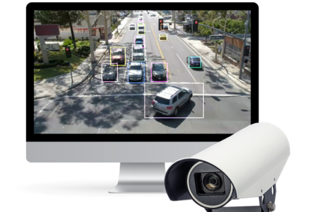
The drones capture and transmit video and traffic data to UC computers using algorithms to count and sort traffic into 14 categories, from motorcycles to the heaviest truck and trailer rigs. UC is providing four certified drone pilots, acquiring permits from the Federal Aviation Administration (FAA), and building a digital platform to analyze the data in the state project. UC uses the latest commercially available drones, which are specially equipped with communications equipment to meet the state’s needs.
UC’s drones can collect terabytes of information, so in another part of the project, researchers are developing a system to aid ODOT visualize the collected data. In the computer science lab at UC, students are working on an augmented-reality system that stitches together photos shot by drones into a three-dimensional rendering.
Unlike virtual reality, which puts the user in a virtual 3D space, augmented reality creates a virtual world around the user in an actual three-dimensional space, such as a conference room. UC is also helping the state develop a simple system to stitch together high-resolution photos from drones into a 3D model in a ‘photogrammetry’ process, which would allow ODOT inspectors to upload pictures and create models with a few computer keystrokes.
“Drones are cool. But if you can’t do anything with the data, they’re pretty pointless,” said Fred Judson, director of programs for Ohio’s Unmanned Aircraft Systems Center. “So, the new metrics we can derive from traffic monitoring will really help us. The drones supplement data the agency collects using manned aircraft.
“But since drones can be launched easily, quickly and at low cost, they have many potential uses. We’re still realizing all the new areas that can use this information. Honestly, we’ve never had this data before. When we have better data, we can make better decisions about our roadways.”


